The former Soviet administrative unit that emerged as independent Ukraine in 1991 after the fall of the Soviet Union was bounded by the exact borders of the Ukrainian Soviet Socialist Republic (SSR). That is, it comprised a wholly unnatural polity whose borders and population had been assembled by successive Soviet leaders for the administrative convenience of their brutal communist dictatorship.
Once the external scaffolding of this Moscow disappeared, that construct quickly polarized along regional and linguistic lines. The red-and-blue electoral map below supplies the generic illustration: Western and central oblasts (blue) delivered overwhelming majorities to candidates oriented toward Ukrainian language and Western institutions, while eastern and southern oblasts (red) – from Kharkiv through the Donbas and along the Black Sea rim including Crimea – delivered equally lopsided majorities to candidates favoring closer Russian ties and greater status for the Russian language.
Accordingly, national results stayed reasonably close; regional electoral results did not. The pattern amounted to a standing de facto referendum for partition.
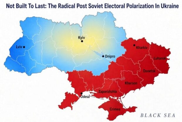
The blue territories of Galicia and Volhynia had spent centuries inside the Polish-Lithuanian Commonwealth and the Austrian Empire, developing under Greek-Catholic and later Polish institutions. The populations there had little affinity for both communism and Russian culture.
The red territories, by contrast, had been shaped by the Czarist Empire: Novorossiya, the Donbas, Kharkiv, and Crimea were settled or industrialized under Russian rule, with heavily Russian-speaking urban populations economically integrated with Russian economic markets and religiously tutored by the Russian Orthodox church.
Both zones carried scars from the depredations of the Second World War: The criss-cr0ssing of the lands first by the German occupation, then by Red Army reconquest. Those nightmarish experiences reinforced the older divergence....
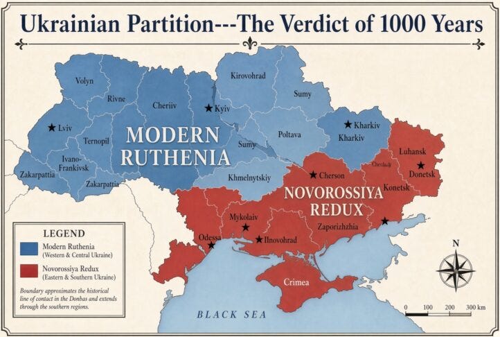
Indeed, 1,000 years of history prove there never was an organic nation of ‘Ukraine” across the territories depicted below. The propinquity of the red and blue regions is nothing more than the desultory work of communist dictators in Moscow who ruled for just 7% of that history.
So, any fair reading says that history – both ancient and recent—has already decided the geography. That is, quiet the guns, dismiss the Washington neocons and let the parties partition these long-suffering lands and peoples – —perhaps along the lines shown below. They track both the history and the current line of contact in the war.
New states that might be described as Modern Ruthenia and Novorossiya Redux would be far preferable for all parties concerned than another $100 billions of destruction and tens of thousands more dead – on top of the 400,000 on each side that have fallen for no valid reason.
And the bonus would be the elimination of the current confrontation between the world’s two most lethal nuclear armed nations.That, along with a dramatic opportunity to bring a major needless outpost of the Empire home.
This article was originally published at AntiWar.com.